Drainage ditch passing by Minamata 2nd Elementary School
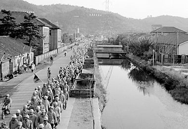
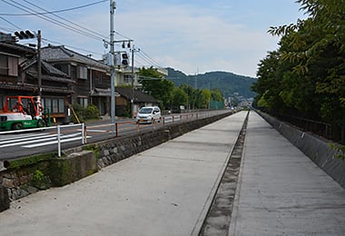
- Date
- Oct. 10, 1962
- Sept. 10, 2014
- Address
- 1-3-1 Sakae-machi, Minamata City


- The drainage ditch of Chisso passing by Minamata 2nd Elementary School. This picture gives an idea of the large width of the ditch.
- The present state of the drainage ditch. The bottom is raised and covered with concrete. It appears to be narrower than before.
Reference sources
- The Edo Period:
The Picture Map of Ashikita-gun, Collection of Kumamoto Gakuen University Library, the late Edo Period. - The Meiji Period:
The Japanese National Atlas at the end of Edo Period and in the Meiji Period, Kashiwa Shobo, Collection of Kumamoto Gakuen University Library, 1983.