The drainage ditch near the east gate of Chisso
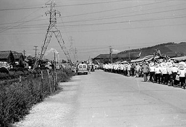
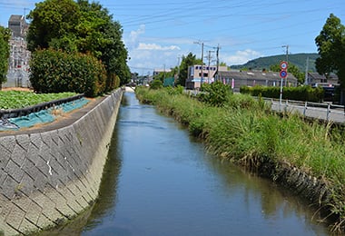
- Date
- Sept. 25, 1962
- Jul. 26, 2014
- Address
- Noguchi-cho, Minamata City


- Demonstrators marching in lines under the power transmission lines of Chisso. There was a big electricity pylon on the left.
- The present drainage ditch, whose bottom surface is now half covered with concrete.
Reference sources
- The Edo Period:
The Picture Map of Ashikita-gun, Collection of Kumamoto Gakuen University Library, the late Edo Period. - The Meiji Period:
The Japanese National Atlas at the end of Edo Period and in the Meiji Period, Kashiwa Shobo, Collection of Kumamoto Gakuen University Library, 1983.