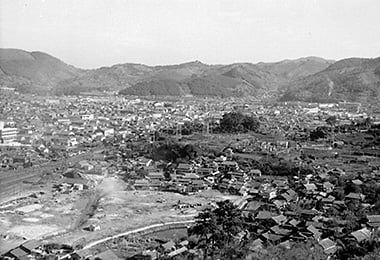
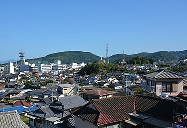
City of Minamata and Gongenyama (Mt. Gongen)
- Date
- Nov. 13, 1962
- Oct. 8 2014
- Address
- 1-chome, Yamate-cho, Minamata


- Mt. Gongen seen from the top of Tatarasan (Mt. Tatara). Minamata City Hall in front. There were few big buildings.
- City of Minamata and Mt. Gongen at present. Large buildings such as the hospital are easy to notice.
Reference sources
- The Edo Period:
The Picture Map of Ashikita-gun, Collection of Kumamoto Gakuen University Library, the late Edo Period. - The Meiji Period:
The Japanese National Atlas at the end of Edo Period and in the Meiji Period, Kashiwa Shobo, Collection of Kumamoto Gakuen University Library, 1983.