Oozono-cho
- Date
- Sept. 26, 1962
- Jul. 26, 2014
- Address
- 1-3 Oozono-cho, Minamata


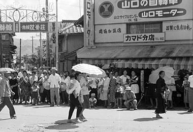
- Around Mutsukado of Oozono-cho. Some distinctive advertisement signs are displayed here and there.
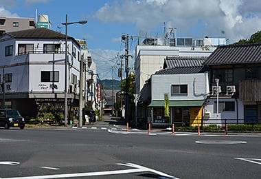
- Mutsukado in Oozono-cho at present. Many cars go by.
Reference sources
- The Edo Period:
The Picture Map of Ashikita-gun, Collection of Kumamoto Gakuen University Library, the late Edo Period. - The Meiji Period:
The Japanese National Atlas at the end of Edo Period and in the Meiji Period, Kashiwa Shobo, Collection of Kumamoto Gakuen University Library, 1983.