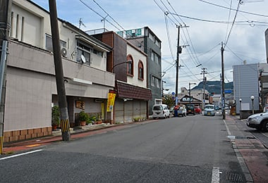
Daikoku-cho
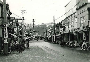
- Date
- Year 1960
- Sept. 22, 2014
- Address
- 1-2-4 Daikoku-cho, Minamata


- The view of Daikoku-cho from Shin-Yotsukado. In front of the shops, a number of bicycles are lined up.
- Around Daikoku-cho at present. On the site where a bookstore was located before, there is a restaurant. On the site where a tailor’s shop was located a dental clinic stands now.
Reference sources
- The Edo Period:
The Picture Map of Ashikita-gun, Collection of Kumamoto Gakuen University Library, the late Edo Period. - The Meiji Period:
The Japanese National Atlas at the end of Edo Period and in the Meiji Period, Kashiwa Shobo, Collection of Kumamoto Gakuen University Library, 1983.