3-chome, Sakurai-cho
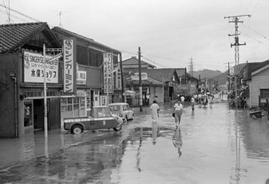
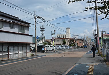
- Date
- Aug. 17, 1962
- Sept. 22, 2014
- Address
- 3-1 Sakurai-cho, Minamata


- The water-soaked road around 3-chome, Sakurai-cho because of heavy rain. An old-fashioned three-wheeled vehicle can be seen in front of the shop dealing in sewing machines.
- Around 3-chome, Sakurai-cho. Some shops, which were torn down, became parking spaces.
Reference sources
- The Edo Period:
The Picture Map of Ashikita-gun, Collection of Kumamoto Gakuen University Library, the late Edo Period. - The Meiji Period:
The Japanese National Atlas at the end of Edo Period and in the Meiji Period, Kashiwa Shobo, Collection of Kumamoto Gakuen University Library, 1983.