1-chome, Sakurai-cho
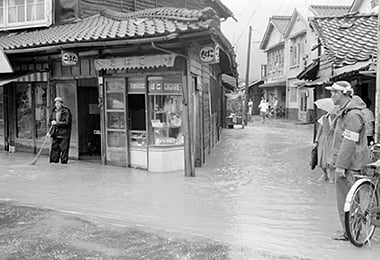
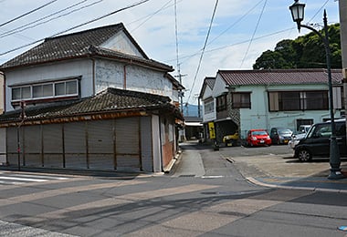
- Date
- Aug. 17, 1962
- Sept. 22, 2014
- Address
- 1-5-1 Sakurai-cho, Minamata


- Due to heavy rains, the roads around 1-chome, Sakurai-cho were flooded. The buildings including the tobacco shop are swamped in this picture.
- Around 1-chome, Sakurai-cho at present. The tobacco shop is now closed.
Reference sources
- The Edo Period:
The Picture Map of Ashikita-gun, Collection of Kumamoto Gakuen University Library, the late Edo Period. - The Meiji Period:
The Japanese National Atlas at the end of Edo Period and in the Meiji Period, Kashiwa Shobo, Collection of Kumamoto Gakuen University Library, 1983.