Scenery from Futagojima Island
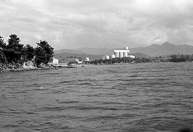
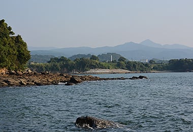
- Date
- Jul.24, 1962
- Sept. 29, 2014
- Address
- 1-chome, Umedo-cho, Minamata


- Futagojima Island on the left, the tanks of Shin Nihon Chemical Co., Ltd. and Mt. Yahazudake in the center of the picture. In 1803 Umedo began to develop, there used to be only several houses of semi-agriculture and semi-fishery. In Futagojima Island, which is 100 meters away from the cape, was full of pine trees and a good place for wickerwork traps. Around 1960, the strait between the Umedo Cape and Futago-jima Island was filled in.
- Mt. Yahazudake seen from Futagojima Island at present. There is no tank of Shin Nihon Chemical Co., Ltd. any more. At the tip of Futagojima Island, there are the two stone monuments, Ebisu: the deity of sea, fishery and commerce, and Ukemochinokami: the deity of food were erected earlier. They still remain as they were.
Reference sources
- The Edo Period:
The Picture Map of Ashikita-gun, Collection of Kumamoto Gakuen University Library, the late Edo Period. - The Meiji Period:
The Japanese National Atlas at the end of Edo Period and in the Meiji Period, Kashiwa Shobo, Collection of Kumamoto Gakuen University Library, 1983.