Countryside in Kojo
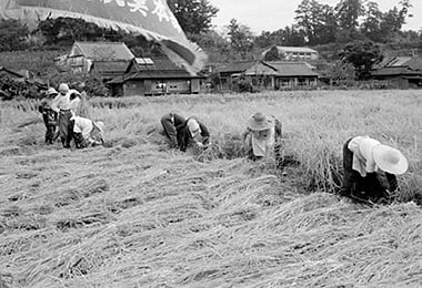
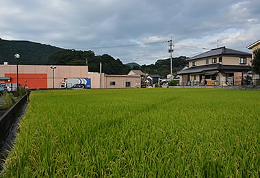
- Date
- Oct. 20, 1962
- Sept 27, 2014
- Address
- 2-chome, Kojo, Minamata


- People are harvesting rice at Itchoda. They bend down and cut rice with a sickle. You can see the house of the highest official in the village and a public health facility.
- The present Itchoda. There is Jinnai branch of Suikosha.
Reference sources
- The Edo Period:
The Picture Map of Ashikita-gun, Collection of Kumamoto Gakuen University Library, the late Edo Period. - The Meiji Period:
The Japanese National Atlas at the end of Edo Period and in the Meiji Period, Kashiwa Shobo, Collection of Kumamoto Gakuen University Library, 1983.