Around Saiwai-machi
- Date
- Aug. 29, 1962
- Sept. 7, 2014
- Address
- 3-1 Makinouchi, Minamata


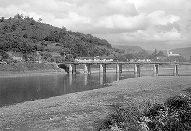
- Saiwai-bashi Bridge and Minamata Daiichi Elementary School. The river coast had hardly been developed. The building with a chimney in the back is Minamata City Hall.
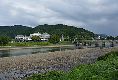
- Saiwai-bashi Bridge and a newly built Moyaikan, which was a medical and welfare complex for citizens.
Reference sources
- The Edo Period:
The Picture Map of Ashikita-gun, Collection of Kumamoto Gakuen University Library, the late Edo Period. - The Meiji Period:
The Japanese National Atlas at the end of Edo Period and in the Meiji Period, Kashiwa Shobo, Collection of Kumamoto Gakuen University Library, 1983.